
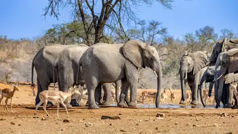
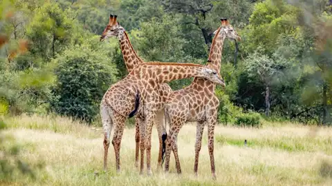
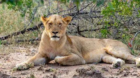
Kruger National Park is South Africa’s largest game reserve, stretching across nearly 2 million hectares along the Mozambique border. Known for its extraordinary biodiversity, it is home to the famed Big Five and hundreds of other species, both large and small. Covering a vast distance from north to south, it provides a truly authentic wildlife experience in one of Africa’s most celebrated ecosystems.
Visitors can explore the park on self-drive routes or opt for guided game drives that share expert insights into the region’s flora and fauna. The Malelane Gate is 102 km from Sudwala Caves, with the Phabeni Gate just slightly farther at 105 km—both ideal starting points for a day trip into the wild.
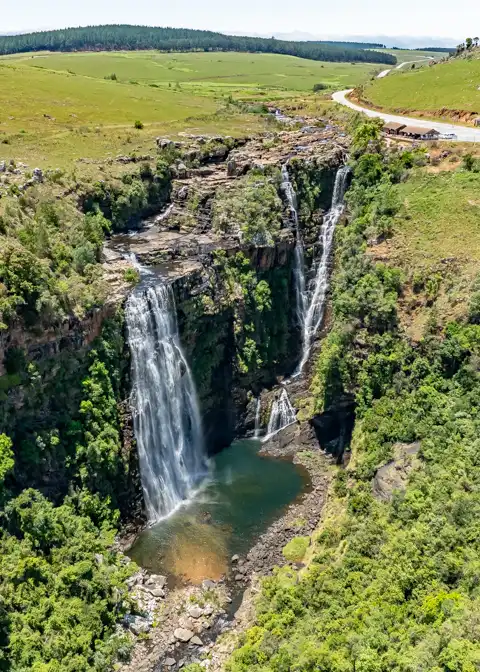
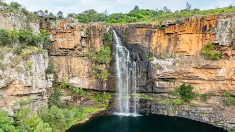
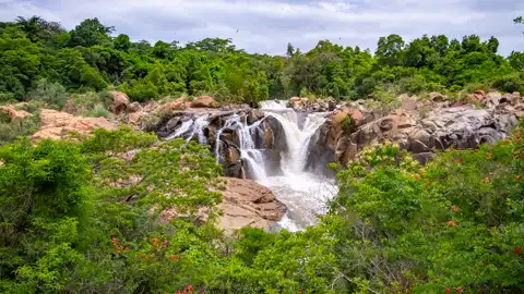
Winding through the rugged escarpments of the Drakensberg mountains, the Panorama Route showcases some of Mpumalanga’s most captivating scenery. Travellers driving along the R532 will discover well-known waterfalls such as Berlin Falls, Lisbon Falls, and Mac Mac Falls—each offering a unique glimpse into the diverse beauty of the province’s landscape.
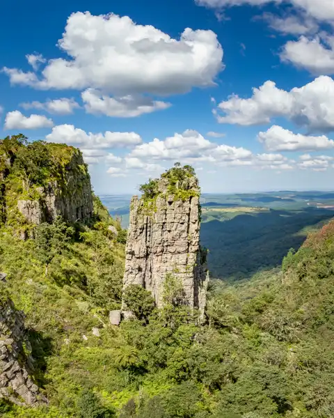
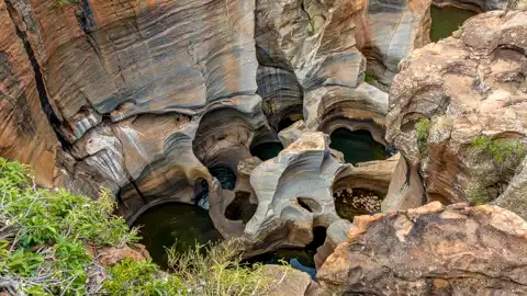
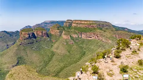
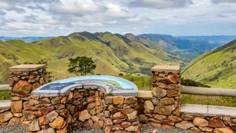
As the journey continues, striking features like Bourke’s Luck Potholes, the towering cliffs of the Blyde River Canyon, and the famous view from God’s Window invite visitors to pause and take in the grandeur. Don’t miss Pinnacle Rock—a towering quartzite spire rising from the valley floor—an impressive sight that adds to the scenic variety. With its winding roads and rich geological wonders, this route makes for a remarkable drive through one of South Africa’s most iconic regions.
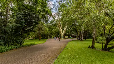
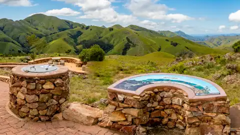
Located on the outskirts of Nelspruit, the Lowveld National Botanical Garden is a vibrant display of regional and exotic plant life. With over 600 indigenous species and more than 2,000 introduced plants, it’s a feast for the senses across its 159-hectare expanse. This garden is also a centre for environmental education and conservation efforts in the Lowveld.
Two rivers—the Crocodile and the Nels—cut through the garden and form dramatic waterfalls, easily visible from well-placed lookouts. Seasonal changes reveal rock formations and riverbanks that highlight the geological diversity of the region. It’s a peaceful and visually rewarding stop for those who appreciate nature and botany.
Step back in time on the Barberton Makhonjwa Geotrail, where rock formations tell the story of Earth’s earliest days. This route showcases geological structures dating back more than 3 billion years, including layers formed by ancient volcanic and sedimentary processes. One of the highlights is the Lebombo Viewpoint, offering dramatic landscapes that stretch across the horizon.
The route offers little in the way of modern facilities or mobile signal, but it rewards the curious traveller with rare geological insights and sweeping views. Those with passports can cross just 2 km beyond the trail to visit Swaziland’s mining museum, adding historical context to this already fascinating journey.

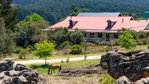
Just 25 km from Nelspruit, the village of Kaapsehoop sits high on a plateau with far-reaching views and dramatic landscapes. Known for its cool misty air and historic charm, the town is crisscrossed with hiking paths that lead to cliffs, waterfalls, and forested areas. Visitors can also explore traces of the area’s gold mining heritage, adding a historical dimension to this scenic setting.
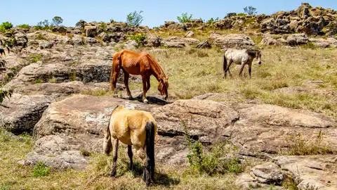
Perhaps most unique to Kaapsehoop is its population of wild horses. Around 200 Boerperds roam freely across the surrounding 17,000 hectares, often seen grazing near town or galloping through the mist. These horses are a beloved part of the local identity and provide a rare and memorable sight for those exploring the area.
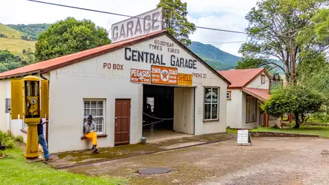
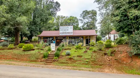
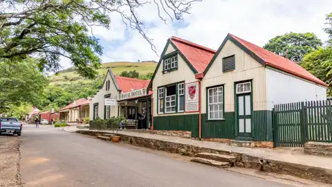
Pilgrim’s Rest is a preserved historic town that echoes the energy of South Africa’s 19th-century gold rush. Established during the second Transvaal gold rush of 1873, it once buzzed with over a thousand hopeful prospectors working thousands of claims. Its early days are still vividly reflected in the preserved architecture and streetscapes.
Now a designated National Monument, Pilgrim’s Rest serves as an open-air museum that brings history to life. Since becoming a tourist attraction in 1970, efforts have been made to maintain its original charm. Visitors can walk the same paths as early miners, explore period-style buildings, and learn about the area's pivotal role in South Africa’s mining heritage.
To explore the interactive Google Map below, click any of the icons on the map or the info icon to the left on the map's menu bar: